Contour maps are specific transparent maps which only contain a system of contours in a vertical distance of 20 or 50 meters. You can't find any other objects on those maps and what is more, regions of other loaded maps can be seen clearly thanks to the transparency of the contour maps. You can put together proper regions of different maps and achieve a fairly good topographical map. You can easy download contour maps of Czech Republic and Slovakia Topo20 and Topo50 from this page completely free and a contour map of Austrian Alps Gtopo30 from this web site.
An European owner of an American version of the GPS instrument can find an interesting solution on the CD 'Trip & Waypoint Manager' which is included in the package of newer GPS instruments as we mentioned above. This CD contains the file TRIPWPT2.img (10.1MB) which will appear on your hard disk after the installation and which contains a rough world map. Details on this map are almost the same as those ones on the basemap in European versions of GPS instruments in European area (not exactly the same). You can load this rough 'basemap' into your instrument with a help of SendMap program even if you are not the owner of the mentioned CD. The same rule is valid for the commercial 'WorldMap' (WORLDMAP302.img - 8.25MB) and for the next commercial product 'Metro Guide' (EuroMGv6.img - 10.6MB).
You can download loads of maps from lots of the internet servers which offer this downloading completely free. The list of the most known servers you can find on this page. However, you have to decide at first which method of downloading into your instrument you will want to use (MapSource or SendMap) and according to the method you have to choose the proper version of the map (IMG or EXE).
Autorouting - navigation cross after cross
Although a pilot in the air will find this function useless, a tourist driving his car can want his GPS instrument to draw up a route from his small village to Paris for him automatically. New instruments like eTrex Legend C, eTrex Vista C, GPSMAP 60, GPSMAP 60C, GPSMAP 60CS, GPSMAP 76C, 76CS, Quest and the rage of GPSMAP 276C, StreetPilot and iQue is provided with this function but be careful. The ability of this autorouting function doesn't mean you can navigate cross after cross in any case. Why not?
Let's go back to the owner of the new mapping GPS instrument who have finished downloading of a free map into a memory of his GPS instrument just now. And he enthusiastically tries to activate his first navigational route which contains three cities Praha, Brno and Ostrava. Unfortunately, the instrument refuses to navigate with an error message 'no roads near starting point' even if he can distinctly see a lot of roads on the loaded map. Why? Although the instrument can provide the Autorouting the loaded map doesn't support this function. Not an expensive commercial map Metro Guide with street details by Garmin can do this Autorouting.
|
Only more expensive City Select map and some commercial versions of Czech maps can do autorouting. What to do now? He has no money to buy these expensive maps but he wants his instrument to navigate from one point (city) to next one at least. It's easy to help. The only one thing he needs to do is to find 'Setup' item in the menu of his instrument and 'Routing' item then. He switches the guidance method to 'Off Road' and that's all. Of course, if his instrument had contained more detailed basemap in the area in which his route had led the instrument would use this basemap for autorouting at least and no error message would show up.
Which GPS to choose?
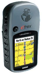
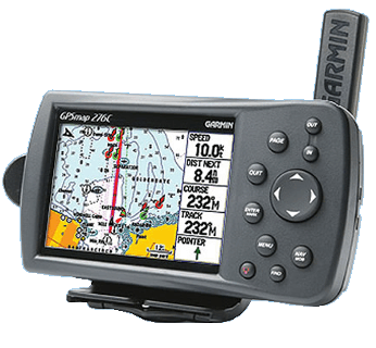
The universal answer doesn't exist. It always depends on the user's expectation and his financial situation, of course. While a poor tourist will probably choose eTrex Legend without a compass, a barometric altimeter and 8MB of free mapping memory will satisfy him, the more demanding user will probably choose coloured GPSMAP 60CS. And a richman who never walks will choose the expensive StreetPilot 2610. Anyway, you have to remember that the GPS instrument without the electro-magnetic compass can't tell you any direction without moving. It doesn't annoy a flying pilot at all because he is moving permanently but a tourist who reached the top of his dreamed up hill won't want to run to force his instrument to tell him where the North is.
Rechargeable NiMH cells seem to be an unbeatable advantage. GPSMAP 60C works with a couple of two cheap NiMH cells with capacity of 2500mAh up to 30 hours continuously. And what is more, it's easy to put two more cells into your pocket and be prepared to exchange them. The producers can reduce the sizes of instruments thanks to using a smaller Li-Ion accumulator (see new Quest) but this solution seems to be more expensive. The accumulator has a capacity of only 1050mAh and it can't be exchanged by user himself as he is used to exchange the accumulator inside his mobile phone. But the size of GPS instruments can't be reduced significantly because of the display resolution. The small map details couldn't be seen on the smaller screen then.
Considering that the difference between European (EU) and American (US) versions of instruments in prices is significant European users often buy the American versions. They know very well the handling of both European and Americna version can be switched to the same languages (the firmwares are the same) and the number of free maps increases gradually.
The choice of the GPS instrument can be much easier after talking to the user who uses some GPS instrument already. Only after using the instrument for some time one can find out which functions he preferes and which one he misses. And which feature seems to be useless for him. Nothing remains but to read any debate on the internet.
|