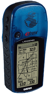
'After I've spent so much money buying the GPS unit I want to gain the maximum of it,' a voice on the telephone line sounds urgently and persistently. As the number of phone calls like this and email questions increases significantly day by day we'll have a look at this topic like a tripper, traveller or pilot who is not decided yet and delays the purchase a new GPS or who unpacked already his new toy with a sparking eyes and he feels helpless and confused now. Anyway he doesn't know how to feed the huge memory of his hungry instrument.
There's no point explaining what GPS is and how it works in these days. We'll deal neither non-mapping instruments nor rather confusing instructions how to turn non-mapping GPS instrument into mapping one because it doesn't work at all. It's not possible fundamentally. Non-mapping GPS instrument is able to display waypoints only and it can't do the essential thing. It means the vectorial drawing which is absolutely inevitable for displaying any map. You can't force any map into the non-mapping GPS instrument even by a hammer. Certainly, you can imitate a part of a road or a creek roughly by a group of proper waypoints but that's not it. You can't make any gold by blowing a cigarette smoke into water, can you?
Basemap - the bottom ground map
Every mapping GPS instrument contains the basemap which is placed in internal memory and can't be changed in any way. Of course, the basemap doesn't interfere in free mapping memory which is intended for loading user maps. The basemap is rather rough with no details however it's more detailed in some areas deliberately. And this is the important point - the main difference between European (EU) versions of GPS instruments and American (US) ones.
European vs American versions of the instruments
However both versions work identically all over the world and the design, the construction and the handling is the same and you can even switch the American version to European languages including Czech and Poland one (except for "x" versions), basemaps are different. While the basemap in European (EU) versions includes primarily areas of Europe, Africa and western part of Asia, the basemap in American (US) versions includes primarily American continent. Why is the word 'primarily' always used? The basemap represents always a map of the whole world although very rough map and less detailed. State borders and coast lines aren't drawn with any great accuracy, roads can't be seen at all and you can only see the biggest cities (Paris, Berlin, Prague, etc.). European (EU) versions contain the rough world basemap which is particularized in the area of Europe, Africa and Asia up to 60° east longitude and American (US) versions contain the same rough world basemap which is particularized in the area of the American continent. Surprisingly, that local particularization of basemaps in newer GPS instruments is worst and less detailed than it was in an older black and white range of eTrex (Legend and Vista). Maybe the producer tries to save the basemap memory size or wants to force users to buy more detailed maps. And maybe both of that. "The world goes wrong," my unnamed classmate always told me with pleasure and I have to agree with Petr Turpis after those years. The basemap in all of the GPS instruments with "Autorouting" function installed usually supports this function but we'll talk over this topic later on.
Free mapping memory
In spite of the fact that you can neither get rid of the basemap nor switch it off, that's no problem for any user. The basemap is covered in given area with sectors (regions) of any user map after loading it into the memory. In other words, the basemap in the given area vanishes under the new loaded map the same way as if the large less detailed paper map (e.g. Europe) laying on the table was covered in its part with smaller and more detailed map (e.g. Czech Republic). While the user can see the more detailed map in given area, the less detailed one can be seen round it. Contour line maps represent the exception. Thanks to the transparency of the contour line map the basemap can be seen completely. Everybody can feel now that those transparency maps are topopographical and they contains no objects except the contour lines.
|
The user can load sectors of his maps absolutely arbitrarily but the sum of its sizes can't exceed the capacity of the free mapping memory, naturally. A data organization of the free mapping memory is not the same as that one of a hard disk. We'll discuss this topic later on.
How to get a map into the GPS
Every dilettante can understand he needs a cable definitely. Every package of the mapping GPS instrument includes a PC connection cable and the serial (RS232) one was usual recently. Considering that the capacity of memory increased gradually and a quantum of a data transfered as well, newer GPS instruments are equiped with USB port now and the PC cabel looks like a digital camera cable. Some types of GPS instruments even use exactly the same cable as digital cameras do. If a loading of 10MB data by the serial (RS232) cable takes almost 20 minutes it takes only 40 seconds now using the USB cable.
The most comfortable and the most frequently used software for a map selection and loading it (waypoints, routes and tracks too) into GPS instruments is MapSource without any doubt. You can find it inside a packages of newer GPS instruments as "Trip & Waypoint Manager". Any user will certainly be insterested in the fact that the program is not bound by any serial number of the instrument.
A freeware SendMap is historically older and a little bit uncomfortable. It exploited the serial port only and what is more the user had to remember a special DOS command "sendmap.exe aaa.img bbb.img ccc.img". But everything has changed recently and the new version (2.0) SendMap20.exe can exploit both serial and USB ports now. After installing the graphical extension Img2gps.exe the work becomes much more comfortable and synoptic, although the abilities of MapSource are always much better. The most important fact for users is that they can download SendMap.exe and Img2gps.exe from this page absolutely free.
The loading map into the GPS memory works like this - every new loading process automatically deletes all user maps which were stored in the memory. For example, if user tries to add to his 50MB map in his GPS the next 1MB map it will finish of the presence of the only 1MB map in the GPS memory as the result of his effort. The previous 50MB map will be simply deleted. Thanks to the programs like MapSource and SendMap which allow to edit the loaded file and build it from any sectors of any map that doesn't present any problem for the user. He only needs to know that rule and remember it.
All of map sectors (regions) are set as active after the loading process immediately and they can be seen after that. Naturally, you can deactivate any map sectors in the menu of the GPS instrument manually and they will simply vanish. You can use this manual deactivation especially when you has loaded several sectors of different maps into your GPS instrument and some of them overlap in a specific area. You can select manually then which sector of which map is displayed in given area. Similarly, you can uncover the basemap by the deactivation some sector or sectors in a specific area.
Maps on the internet
The best free map of Czech Republic is cz_map.exe (size 4MB) with no doubt. That map is even more detailed in the region of Czech Republic than the basemap in European versions of GPS instruments as everybody can clearly see on this picture. However an old non-coloured GPS instruments can't utilize the abilities of this excellent map. Blue waters and black roads blend the same way as you can't recognize colours on black and white TV screen. But who watch non-coloured TV screen nowadays and who take black and white photos? According to the latest news Czech authors are preparing the next better version which contains all of the airports in Czech territory.
|